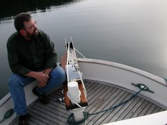


Well, we headed out to Blunden Harbour to begin our approach to Cape Caution but the weather and seas were so nice that we continued on to Allison Harbour next to Nakwakto Rapids. Allison Harbour (N 51 degrees 03.439' W 127 degrees 30.501') is beautiful and quiet.
Since we skipped an anchorage, we moved the crossing date up to Saturday.
"What a Day"
Saturday began with calm winds and heavy fog. While I was sitting in the pilothouse drinking my coffee and thinking I could just as easily be in a Starbucks somewhere in Seattle instead in pea soup with Cape Caution staring me in the face, I heard Comox Coast Guard Radio taking the information from a 32' sailing vessel that was issuing a Mayday after they hit Mary Rock in the fog (0800hrs.). We had passed Mary Rock the day before and were anchored 10.5nm NW of that location.
Port Hardy sent two Coast Guard Rescue boats and three other boats were within 30 minutes of their location. I could not hear the boat's radio traffic but I know they were giving a description of their life raft. Two hours later I heard Comox tell a boat that the sailboat was off the rock but nothing else. A Mayday in the morning wakes you up almost as well as a good cup of coffee!
At 0825hrs., we left the security of Allison Harbour and stuck our anchors into the fog. The boat ahead of me had much more sophisticated radar and chart plotters and this was my first time ever running in the fog. The skipper had explained a little about his system so I knew it was just right for this kind of monkeying around. He has AIS which allows him to see on his plotter anything over 500 tons, their name, bearing, course, cargo, port of call and on and on. We ran the first two hours in the fog. At one point He identified a BC Ferry bearing down on us at 15.9 kts. I was able to pick it up on my radar but determining what it was just isn't that easy. He made contact after two attempts and we passed at a safe distance. The ferry is quite big and was quite startling to see bursting out of the fog so close. If I had been by myself, I might have had a much closer view.
We broke out of the fog and the sea conditions , once again, were great. From what I understand, it probably was as good as it gets for Cape Caution. Swells and wind waves were probably less than 1.5 meters combined to start but rose a little as time went on. Passed the Cape at 1155hrs., June 3, 2007. We parted ways after the Cape and I continued on to Green Island Anchorage (N 51 degrees 38.689' W 127 degrees 50.195'). The conditions were deteriorating rapidly after passing Cape Calvert and heading into Fitz Hugh Sound so I pushed a little harder to get in.
Running up the middle of Fitz Hugh Sound, a very large and loud Coast Guard helicopter flew directly overhead at low altitude. I was a little surprise but grabbed my binoculars to get a good look. When I lowered the binoculars, there were whale flukes about fifty yards directly in front of me! The tail was about ten feet in the air and must have been as wide as my boat. Another first for me!
I now understand why Cape Caution is such a barrier to going north for so many people. I guess I will get to see what it like going south also. This is a big deal for a slow boat.


3 comments:
Way to go, Frank! I'm charting you every step of the way. And I am surprised that you're getting WiFi at Green Island Anchorage...
I just LOVE firsts! And you're having so many. What an adventure, Frank! Very, exciting. I'm very happy for you. ~Cheers, Gigi
Interesting to know.
Post a Comment