Friday, June 8, 2007

Shearwater to Butedale in One Hop. 75nm


Leaving out of Shearwater on Monday morning under heavy clouds and rain, the first thing I encountered was a BC Ferry southbound in the narrow channel to Bella Bella. Fortunately the big ships announce their intent to transit these narrow passages so I had time to turn around and wait her out.

I followed another cruising boat through and headed down Seaforth Channel towards Ivory Island and Milbanke Sound. There a person has a choice; turn at Ivory Island and take the inside and more protected route or turn into Milbanke and take the faster route. The winds were fairly calm and the gale warning had been lifted for the outside. The closer I got the bolder I felt. A welded aluminum salmon troller had been following me and when the boat ahead turned inside, the troller continued towards Milbanke.

I called the troller on the radio and chatted. He said the route through Milbanke Sound was indeed a lot quicker. I asked his opinion about what he thought the conditions might be in the sound. He said "There's not much happen'n out there. No problem, follow me!".

"Not much happen'n" and "No problem" need to be viewed in light of one's range of experiences.

He was using his and I was using mine. The two are not the same.

Soon we were in 3 to 4 meter southwest seas on the port beam and quarter, remnants of the dying gale blowing the night before. Forty-five degree rolls for the next two hours. The surge was so big that the breakers were marking the rocks with spray 50 to 75 feet into the air! Yeah, "No problem" seeing where the rocks were!

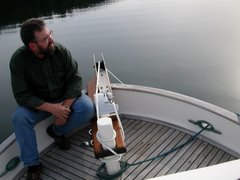
A long way into Finlayson Channel the troller came to a stop. The skipper was out on the deck as I slipped up alongside. He said he needed to change a fuel filter and that I didn't need to wait. I said OK and then said "I'm sure glad that was so flat back there!". With a big grin he said "Yeah, that was nice!". I think he was serious.

I began thinking that I had saved enough time that possibly I could skip an anchorage and pick up a day in my schedule to get to Prince Rupert to meet Ginger. I had planned to stay in Bottleneck in Finlayson Channel but I turned into Tolmie Channel and just kept going. Tolmie Channel turns into Princess Royal Channel, long and narrow with high mountains on both sides and beautiful waterfalls all along it.

Butedale ( N 53 degrees 09.624' W 128 degrees 41.673' ) was my next scheduled stop and I arrived there at 1900hrs. A long day, 75 nm is a long day in this slow boat alone. Lou Simoneau is the caretaker here and I think he and Butedale are a perfect match. A very nice fellow. In the photos you will see the beautiful waterfall and how Butedale, an old fish processing plant, is falling into the sea. Lou told me there has been a white bear hanging around the beach the last couple days but I was not fortunate enough to see it.

Sitting here in Prince Rupert I must say, the internet connections are very spotty. I have been kicked off a hundred times or more but I will continue to try to post.

Thursday, June 7, 2007

Hello From Prince Rupert! 597nm


I am sitting at the dock at Prince Rupert Yacht and Rowing Club, a couple days ahead of time. It has been an interesting four days.

I will try to catch up using separate posts for each day (after this one) so as to not confuse me or you.

I will however tell you about a bit of an interesting situation occurring here and in a few smaller towns in the area.

Apparently, this area received more snow this winter than any time since the 1950's. 50 to 60 feet in some of the mountains, according to the locals. A lot of the snow was late in the season , very wet and heavy. Now, of course it is rapidly melting. Two days ago the Skeena River washed out the only highway and the railroad. This town is now cut off from the rest of the world, at least as far as moving freight and goods by rail or road. Some places are already out of diesel and gas and the sources that have any are rationing their supply.

I went to the Safeway store and there is no milk, eggs or flour and very little fresh produce left in town. Everyone went into a bit of a panic and started laying in their supplies. I guess a couple of the smaller towns already have partial evacuation orders in place.

Prince Rupert is one of my planned fuel stops so I will have to wait to see if this problem will affect my plans. The next fuel stop is probably Ketchikan.

I am glad that you all are following along and I really enjoy reading your posts. It means a lot when you are traveling alone but can feel connected.

A Note; Verizon says they have cell service in Prince Rupert so long as you have the correct plan and jump through a couple extra hoops. Not true! The locals say no one gets Verizon service here and haven't for years. So, if anyone sees my wife, please tell her I'm patiently waiting for her in Prince Rupert. Thanks!

UPDATE! The Prince Rupert Coast Guard just broadcast a message; All marine fuel has been seized by the Navy and is being held for essential governmental purposes only! Ouch!

Sunday, June 3, 2007

Early Start


I keep hearing about all the bad weather outside and how it is going to get worse in the next few days so I pulled the anchor at 0515hrs. today the third of June. I looked out through a gap and saw fog again. This time I was just determined to run it. As I got outside of Green Island Anchorage I took this photo of the moon and mist. As it turned out I didn't get into any fog at all.

Today is a double post; The Cape post was done after I arrived at Shearwater this afternoon (N 52 degrees 08.852' W 128 degrees 05.305'). You are right in your surprise, Owen, there is no WiFi at Green Island, I was just catching up.

The cruising weather was great once again, still no storm. The early morning start was nice. I am a morning person and it was just beautiful. At the top of Fitz Hugh Sound I turned into Lama Passage and motored into Bella Bella and Shearwater. There is good cell service out in the bay in front of Bell Bella if you have the correct phone company. That would be Verizon. I've talked to other people who have been here recently and they could not get any signal at all with other companies. I even had one bar of signal at the dock in Shearwater and could make calls from there.

The WiFi here is $7.00/hour! But you can't even get a password until the store opens at 0900hrs. tomorrow. However, the WiFi at the pub is having some technical difficulties and is wide open and $0.00/hour. Shearwater is a newer place but seems to be lacking in coordination and customer service.

I changed the Racor 500 filter last night and changed the engine oil and filter today. There was only 76 hours on the oil since leaving Anacortes but with the "oil milkshake" at the beginning of this trip, I just thought I would give my engine a little treat!

Now I might hazard a guess on the next communication. I don't think there is much between here and Prince Rupert for either cell service or internet so you might not hear from me for awhile. If things go according to schedule, I plan to meet my darling wife in Prince Rupert on June 10. Ginger will fly to Vancouver, B.C. in the morning and then on to Prince Rupert. This has all been precisely coordinated without the ability to communicate for the seven days prior. I just hope we both show up at the same place and the same time. It will take Ginger one day to get to Prince Rupert, it will have taken me 22.

Fog, Rock, Ferry, Cape and Whale


Well, we headed out to Blunden Harbour to begin our approach to Cape Caution but the weather and seas were so nice that we continued on to Allison Harbour next to Nakwakto Rapids. Allison Harbour (N 51 degrees 03.439' W 127 degrees 30.501') is beautiful and quiet.

Since we skipped an anchorage, we moved the crossing date up to Saturday.

"What a Day"

Saturday began with calm winds and heavy fog. While I was sitting in the pilothouse drinking my coffee and thinking I could just as easily be in a Starbucks somewhere in Seattle instead in pea soup with Cape Caution staring me in the face, I heard Comox Coast Guard Radio taking the information from a 32' sailing vessel that was issuing a Mayday after they hit Mary Rock in the fog (0800hrs.). We had passed Mary Rock the day before and were anchored 10.5nm NW of that location.

Port Hardy sent two Coast Guard Rescue boats and three other boats were within 30 minutes of their location. I could not hear the boat's radio traffic but I know they were giving a description of their life raft. Two hours later I heard Comox tell a boat that the sailboat was off the rock but nothing else. A Mayday in the morning wakes you up almost as well as a good cup of coffee!

At 0825hrs., we left the security of Allison Harbour and stuck our anchors into the fog. The boat ahead of me had much more sophisticated radar and chart plotters and this was my first time ever running in the fog. The skipper had explained a little about his system so I knew it was just right for this kind of monkeying around. He has AIS which allows him to see on his plotter anything over 500 tons, their name, bearing, course, cargo, port of call and on and on. We ran the first two hours in the fog. At one point He identified a BC Ferry bearing down on us at 15.9 kts. I was able to pick it up on my radar but determining what it was just isn't that easy. He made contact after two attempts and we passed at a safe distance. The ferry is quite big and was quite startling to see bursting out of the fog so close. If I had been by myself, I might have had a much closer view.

We broke out of the fog and the sea conditions , once again, were great. From what I understand, it probably was as good as it gets for Cape Caution. Swells and wind waves were probably less than 1.5 meters combined to start but rose a little as time went on. Passed the Cape at 1155hrs., June 3, 2007. We parted ways after the Cape and I continued on to Green Island Anchorage (N 51 degrees 38.689' W 127 degrees 50.195'). The conditions were deteriorating rapidly after passing Cape Calvert and heading into Fitz Hugh Sound so I pushed a little harder to get in.

Running up the middle of Fitz Hugh Sound, a very large and loud Coast Guard helicopter flew directly overhead at low altitude. I was a little surprise but grabbed my binoculars to get a good look. When I lowered the binoculars, there were whale flukes about fifty yards directly in front of me! The tail was about ten feet in the air and must have been as wide as my boat. Another first for me!

I now understand why Cape Caution is such a barrier to going north for so many people. I guess I will get to see what it like going south also. This is a big deal for a slow boat.

Thursday, May 31, 2007

Just When You Think You Can't Connect.


Hello again!

One thing that really comes through about a cruising plan up here is that you need to be ready to change it quickly and often. We intended to stay at Greenway Sound tonight but when we got there, the place was closed up tight and not a soul was in sight!

We motored on into Sullivan Bay (photo) and are going to spend the night at the docks here. (N 50 degrees.097' W 126 degrees 49.691'). This place has good facilities but is open only for fuel and moorage during the "off season". The restaurant opens June 1st. However, the folks I am traveling with ran into two other couples in two boats that they know from Oregon and so there is a group of seven. The restaurant has agreed to open a day early just to accommodate us! So we go from no customer service to excellent customer service in a flash! Moorage rates are $o.50/foot today and $0.80/foot beginning tomorrow. I haven't checked on the fuel price here yet, but in answer to Owen's question, Echo Bay is the highest I've seen so far on this trip. I have been paying at least $1.18/liter.

This change in plans has moved the Queen Charlotte Sound crossing up one day to Sunday morning, weather permitting. The sailboat, of course can take a lot more rough water than DUNVEGAN but I have promised to push as hard as I can so as to stay on the crossing schedule, if possible. I installed a new radar reflector this morning so at least the big boys should be able to see me as I'm getting in their way.

I am going to stop trying to predict when and where I might have WiFi, I missed several times already.

Wednesday, May 30, 2007

Opportunities to Communicate Becoming Fewer


Hello! It's Wednesday and I am at the dock in Echo Bay Resort, all alone. I mean, DUNVEGAN is the only boat in the whole marina! I just gave them $92.36 for 15.9 gallons of diesel. Maybe that is the reason I am the only boat in the marina! (N 50 degrees 45.155' W 126 degrees 29.870').

Since Shoal Bay I have been cruising with a great couple aboard a 40' Endeavor sailboat. They have far more experience than I do and I think they sense some of my concern. They have been good morale boosters! Last night we anchored in Cutter Cove across from The Blow Hole on Minstral Island. The night before we anchored in Forward Harbour just north of Whirlpool Rapids at the east end of Sunderland Channel. Sunderland connects to infamous Johnstone Strait which was really calm during our transit. We plan to travel together for the next several days. Hopefully, we will be crossing Queen Charlotte Sound together on Monday morning. 267 nm so far.

I had fresh shrimp for dinner tonight. I had to barter for the shrimp from a shrimp boat. I used money and they used shrimp. It seems to work well that way.

Sorry for the short post but I will be powering down shortly. I will update when possible. I do thank everyone who has posted here and I am looking forward to more!

Sunday, May 27, 2007

Rapids? What Rapids?


Cruising up Lewis Channel from Refuge Cove to the rapids.

I knew if my plan was going to work, there were some things that just needed to be done. like crossing the Strait of Georgia and running the rapids. There still are many more in the same category.

Today I took care of some of those things. Yuculta Rapids, Gillard Passage and Dent Rapids. Now, I have actually been through these a couple times before but I either had someone else in the boat or I was singlehanding but running with another boat. Today I was all alone in a slow boat.

I have read just about everything written about these rapids and I must say, if you follow the advice given in the Waggoner Cruising Guide and the Douglass' Exploring Series, everything will probably work out just fine! I slipped through without knocking anything to the deck and with only a tiny bit of psychological damage, (spread out over the entire morning of course!).The nice thing about the rapids is, unless there is genuine trouble, it only lasts a short time. On the other hand, the Strait can beat you to death for hours!

Right now there are gale force winds blowing in Johnstone Strait and my next leg will take me through there so I am going to go with plan B, just as soon as I figure out what plan B is.

I am currently sitting at the dock in Shoal Bay where the bulk of the wind can't quite get a purchase on the water. Mark McDonald, who runs the lodge here, provides free WiFi but there is no cellphone service. ( N 50 degrees 27.508' W 125 degrees 21.955' )